Water risk
Screen assets against water-stress and water-availability indicators to identify locations where water may affect project development, operations or stakeholder risk.
Available metrics
Global Mining Dataset brings mining asset locations, water, infrastructure, jurisdiction and constraint layers into one workflow, helping teams compare assets before deeper diligence begins.
Start with 25,000+ mapped mining assets or upload your own private locations for enterprise screening.
Combined dataset
Mining asset screening usually starts with scattered mine lists, GIS layers, spreadsheets and one-off datasets. Global Mining Dataset combines these inputs into a structured asset view, so teams can move straight to comparison rather than rebuilding the data foundation every time.
Each asset is connected to location-based context across environmental, infrastructure and geopolitical constraints, creating a consistent basis for first-pass screening.
Mining asset locations
Mine and project records
Environmental datasets
Environmental risk signals
Location
Nearby constraint signals
Jurisdiction risk
Country and regional signals
Infrastructure
Access and proximity layers
Operational data
Customer-owned coordinates
Global Mining Dataset
Normalised asset spine for screening-ready records
Public, private and geospatial datasets are normalised into one asset spine, giving every record the same screening structure for comparison across countries, commodities and portfolios.
Risk layers
Every asset can be screened against the same location-based risk layers, helping teams identify above-ground risk earlier in the evaluation process.
The goal is not to replace detailed diligence. It is to create a consistent first-pass view of where above-ground risks may affect project priority, timeline or commercial attractiveness.
Screen assets against water-stress and water-availability indicators to identify locations where water may affect project development, operations or stakeholder risk.
Available metrics
Review the methodology, data sources and layer definitions behind Global Mining Dataset.
Screening workflow
Use the screening workflow to filter assets, inspect location-based risk, build shortlists and generate review-ready outputs for internal analysis, investment memos and downstream diligence.
Filter the asset universe by commodity, country, project type, ownership, status and above-ground risk indicators.
Inspect assets spatially alongside water, infrastructure, jurisdiction and constraint layers to understand the local context behind each screening result.
Turn selected assets into structured screening outputs for internal review, investment memos, client work or diligence handoffs.
The same screening fields follow each asset from the dashboard, into the map view, and through to the report generator. Teams can filter a longlist, understand why assets are flagged, build a shortlist and export review-ready outputs without rebuilding GIS layers or reformatting spreadsheets for every review.

Private assets
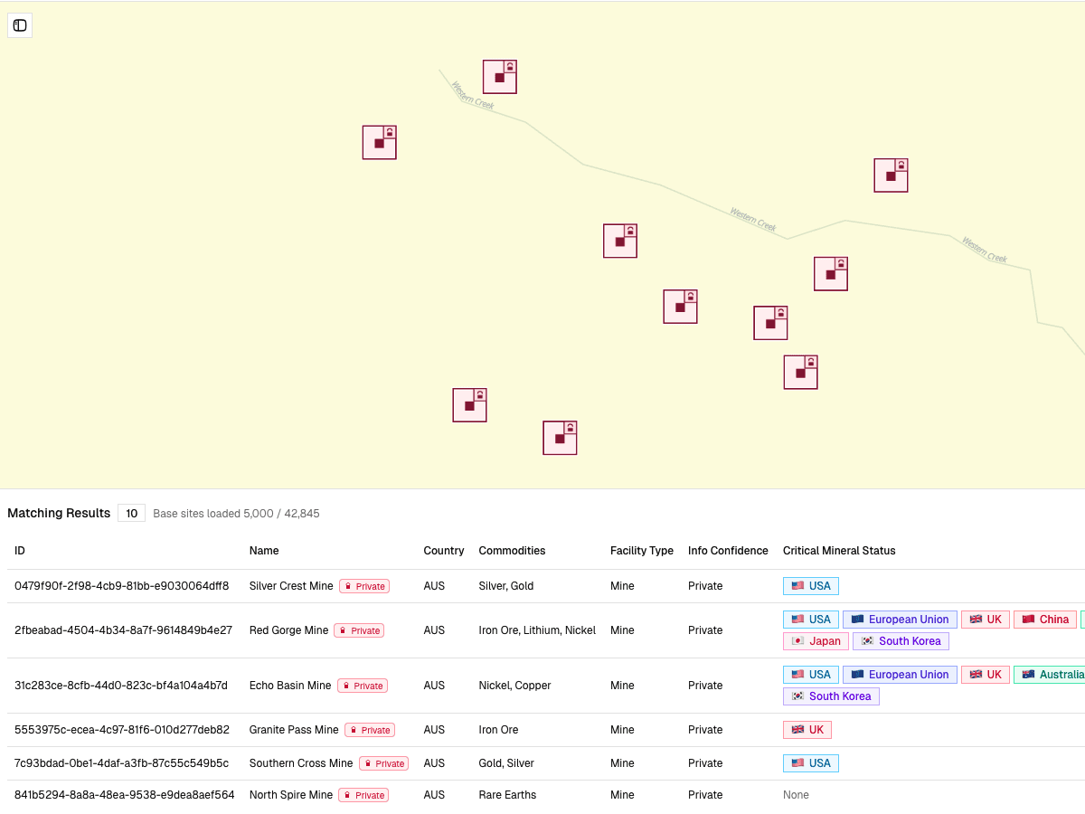
Enterprise users can upload internal project lists, supplier locations, acquisition targets or other private coordinates and screen them against the same water, infrastructure, jurisdiction and constraint layers used across the shared dataset.
Private records remain separated from the shared platform dataset, while still producing comparable screening outputs.
Internal projects, supplier sites or deal targets
Add asset names, coordinates and project attributes from internal lists or private portfolios.
Same metrics as the shared dataset
Enrich each private location with water, infrastructure, jurisdiction and constraint indicators.
One screening structure across both datasets
Review private locations alongside public assets using the same comparable fields and screening logic.
Move results into downstream review
Export screening outputs for investment reviews, supplier assessments, client work or diligence materials.
Private asset workflows are available on enterprise plans for teams that need to screen internal projects, supplier sites, acquisition targets or other private locations against the same above-ground risk framework.
View pricing plansBefore and after
Before Global Mining Dataset, teams spend time assembling asset lists, GIS files, infrastructure layers, water datasets and jurisdiction indicators before assets can even be compared.
With Global Mining Dataset, those inputs are brought into one screening workflow, giving teams a faster and more consistent way to compare mining assets at the pre-diligence stage.
Before
With Global Mining Dataset
Asset lists, GIS layers and spreadsheets assembled manually
A combined mining dataset already structured for screening
Different analysts using different assumptions
Consistent risk metrics across every asset
Time spent preparing data before comparison
Time spent reviewing and prioritising assets
Outputs rebuilt for each project or review
Exportable screening records for downstream workflows
Get started
Book a demo to see how Global Mining Dataset combines asset data, risk layers, screening dashboards and private-location workflows into one repeatable process.